An Australian project reveals surprising results at mineral sands mine
Over a four-year period, Total Hydrographic undertook a project at a mineral sand mine to survey the condition of the mine’s dredge pond. Survey was conducted utilising manned and unmanned vessels. Our vessels are equipped with dual-frequency Single Beam Echo Sounders (SBES). The project revealed the ongoing need for manned surveying, especially when monitoring acoustically and navigationally challenging environments.
PROJECT OVERVIEW
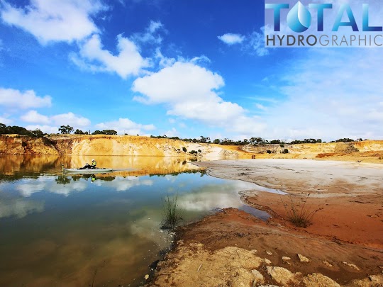
Total Hydrographic conducted a series of dual-frequency SBES surveys at a mineral sand mine located in Australia. As part of the mine’s operations, sand is extracted via a cutter suction dredge back to the plant for processing. The tailings from processing the sand are then pumped back to the dredge pond (tailings dam) to settle. To ensure uninterrupted operations, the mine engaged Total Hydrographic to undertake regular shallow water surveys to monitor the condition and capacity of the tailings dam.
The equipment used throughout the project included:
- Leica GS14 RTK GNSS
- CEE HydroSystems’ CEESCOPE with a 200khz/24khz transducer
- Xylem’s Hypack Software
- 4m open hull vessel with outboard motor
- Unmanned Surface Vehicle (USV)
- Hobie Pro Angler 14 Kayak
MONITORING THE TAILINGS DAM
The initial surveys were conducted in a good acoustic environment with a generally clear water column. As sediment levels increased and the tailings dam progressed through its lifespan, the acoustic environment and the water column deteriorated. This presented a challenge as we continued to monitor conditions throughout the four-year project.
We utilized both manned and unmanned vessels during the project. Using high and low-frequency SBES to monitor the build-up of sediment on the dam floor.
MANNED vs. UNMANNED VESSELS
We used several manned and unmanned vessels during the four-year project to monitor the condition and capacity of the tailings dam. We found that each vessel used in the project had different strengths and weaknesses. Our challenge was to choose the right vessel to provide effective survey results, which became more critical as the condition of the dam deteriorated.
The table below indicates the relative strength and weakness of each vessel used:
| Vessel | Strength | Weakness |
| 4m open hull with outboard motor | Most efficientProvided the best understanding of the environment for the hydrographer | Required a basic boat ramp to launch |
| Unmanned Surface Vehicle (USV) | No personnel on waterDidn’t require a boat ramp to launch | Least efficientNo understanding of environment for the hydrographer in the middle of the dam |
| Hobie Pro Angler 14 Kayak | Didn’t require a boat ramp to launchProvided the best understanding of the environment for the hydrographer | Less efficient than 4m open hull with outboard motorIncreased risk of exposure to tailings/water |
As the table shows, USVs were easy to launch and didn’t require personnel to be on the water. While effective at the start of the project, USVs ended up providing the poorest understanding of the environment as the water column filled with sediment. It is difficult to validate the observations from unmanned surveys as tailings continue to be deposited into the dam, without on-water confirmation (only possible with a manned vessel).
MANNED VESSELS MORE EFFICIENT
Over time, we found manned vessels were far more efficient than the USVs in undertaking survey operations at the tailings dam.
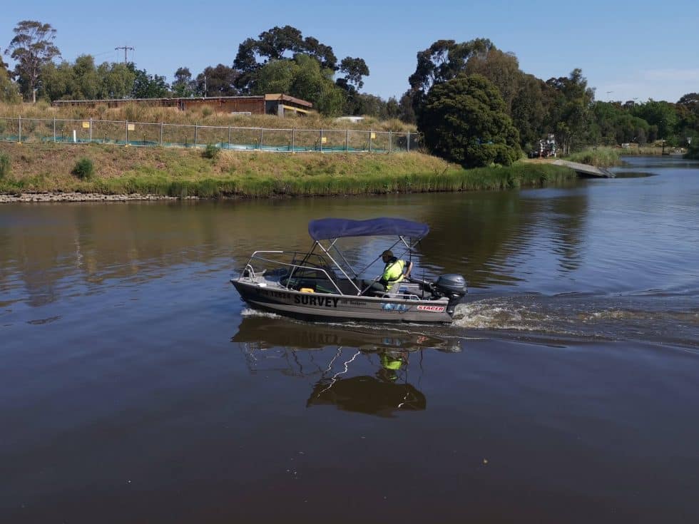
While our manned vessels were more difficult to launch than USVs, having qualified staff on the water provided the best possible understanding of the changing environment, which was impossible to capture from the water’s edge. The ability of our manned vessels to immediately validate SBES observations became invaluable as the acoustic conditions deteriorated during the project.
It became impossible to understand the thickness of the tailings from a USV alone, requiring greater use of manned vessels. It was always more difficult to manoeuvre USVs in the dam, navigating them around dredge pipes and distant banks with submerged shoals. The USV was easy to launch without a boat ramp, however using the USVs were found to be more difficult and a lot more time-consuming than manned vessels.
Surveying an environment subject to continuous change (like a tailings dam) requires a flexible approach. Our experience highlights the ongoing value of using manned vessels in shallow water surveying. While the use of USVs is becoming more common, unmanned vessels may not always be the most efficient choice in challenging shallow-water environments.
THE CHALLENGE OF SUSPENDED SEDIMENTS
As sediment levels increased, our monitoring efforts were impacted by suspended sediment in the tailings dam. This not only affected the survey vessels we used, but it also challenged our SBES system.
One survey, in particular, returned unexpected results, revealing a suspended layer within the water column. Fortunately, we were surveying in a manned vessel at the time and immediately validated the existence of the suspended layer by probing the water column with a survey level staff.
As the presence of suspended sediments grew, the high frequency (200khz) SBES was unable to penetrate the suspended layer. Fortunately, the low frequency (24khz) could still penetrate the suspended layer to find the harder bottom. The diagram below demonstrates the difference between the high frequency (top digitized line) and the low frequency (bottom digitized line) SBES results. Without this echogram capability we would not have been able to process any useful results.
Towards the end of the project, the growing sediment levels began to restrict our survey efforts, even making it difficult for our kayak to navigate across the surface.
RESULTS
The most recent survey of the dam revealed the water column was full of suspended sediments, preventing the high-frequency SBES from even penetrating through its blanking range. Fortunately, the low-frequency SBES was still able to provide some indication of where the harder bottom was located.
Even though this survey is the least complete in our series (due to the sediment obstructing the SBES observations), it still provided valuable insight. While this survey did not return precise results, these findings led to conclude that the tailings dam had reached capacity. Capturing this survey with a manned vessel confirmed the presence of a suspended sediment layer approximately 100mm below the water surface and supported this conclusion.
CONCLUSION
Tailings dams have proven a tricky environment both acoustically and navigationally throughout this project. Surveying such a changeable environment requires a flexible approach in the use of vessels and equipment. While unmanned vessels are increasingly popular in the hydrographic surveying industry, our experience highlights the value of operating manned vessels, especially when navigating complex waters.
The project also proved that while the perfect survey cannot always be achieved, every survey can still deliver valuable information. The most recent survey, while of low confidence in terms of precise results, was possibly the most valuable as it correctly indicated that the tailings dam was near capacity.
Our experience shows that a flexible approach is required when undertaking a complex shallow-water survey. Being open to using both manned and unmanned vessels and closely analysing every piece of data is the key to delivering a high-quality result.
Recent Comments