Know More About Hydrographic Consultancy
Total Hydrographic are your certified Hydrographic Surveyors and Marine Mapping/GIS professionals.
Our Services
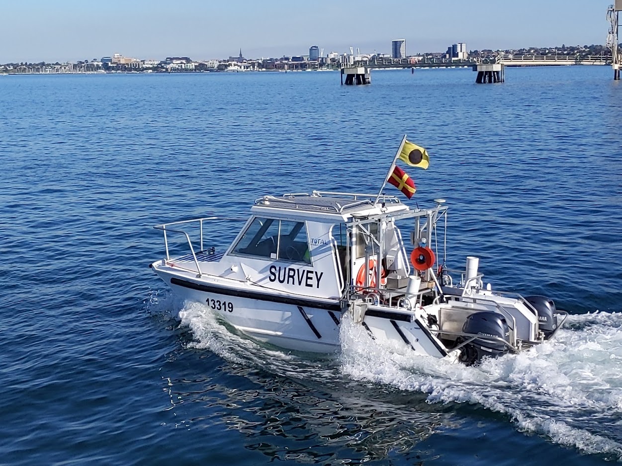
Bathymetric Surveys
Side Scan Sonar Surveys
Hydrographic Data Analysis
Terrestrial Surveying
Hydrographic Consultancy
Bathymetry is the study and mapping of the sea floor. Bathymetric surveys allow for us to measure the depth of a body of water as well as map its underwater features. Bathymetic data is used in a range of applications, some include:
- Hazard Detection
- Safety of Navigation and Nautical Charting
- Determiniation of Maritime Boundaries
- Environmental Management, including developing baseline data
- Research for Coastal and Marine Processes
- Installation of Maritime infrastructure
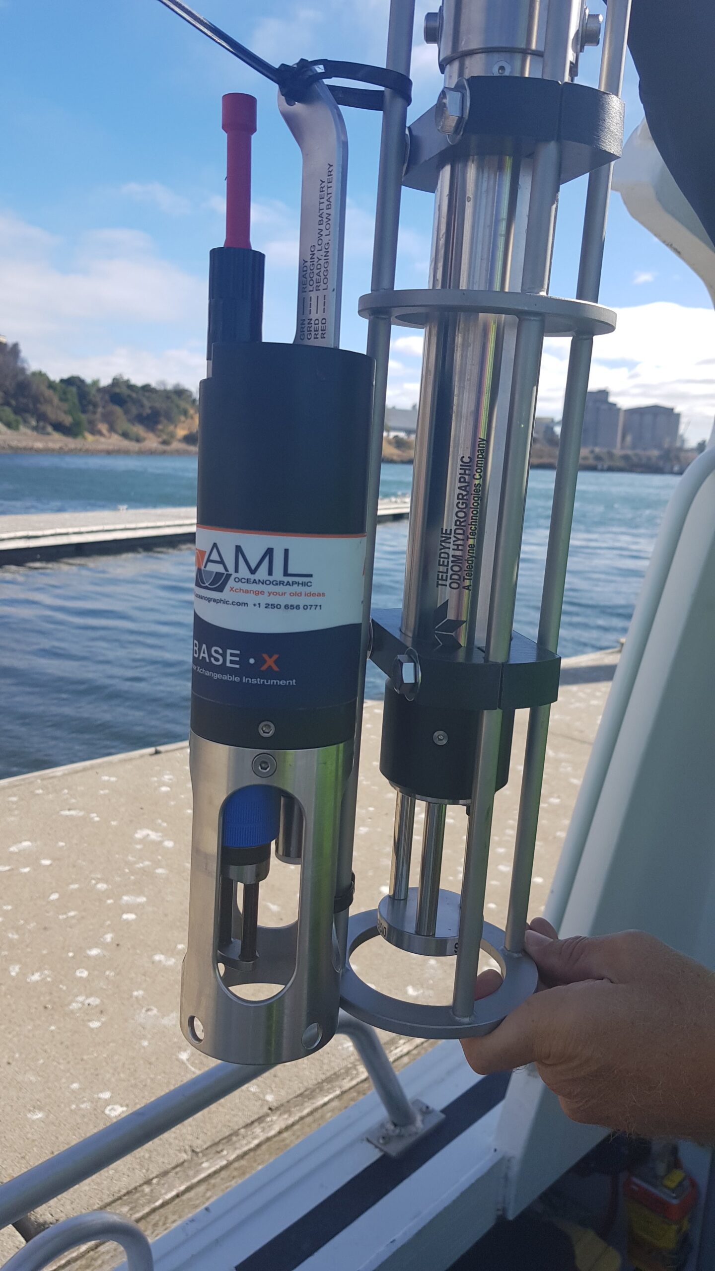
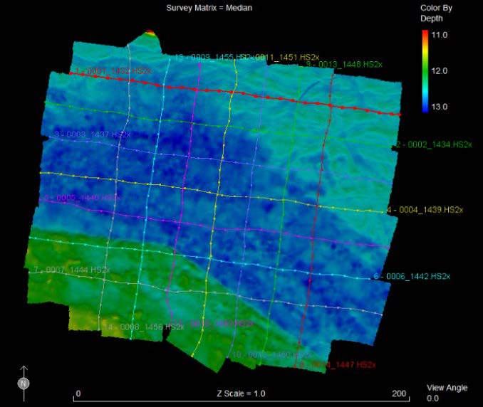
At Total Hydrographic we gather bathymetric data in a variety of different methods and equipment. Our Multibeam Echosounder (MBES) is a full bathymetric seafloor coverage system. The MBES system emits 512 beams in a fan shape beneath the boat allowing the system to capture up to 200,000 soundings per second and ensure maximum coverage of the seafloor.
Our Single Beam Echosounder (SBES) on the other hand, captures data using a single beam directly below where the system is mounted. Single Beam surveys are at a pre-defined line spacing; for example 2m, 5m, 20m. The size of these intervals determines the final resolution of the survey.
Multibeam survey and Single Beam surveys are each best suited to their own individual set of circumstances, locations and client needs. Total Hydrographic can help by recommending a particular solution specific to your own requirements and priorities as both MBES and SBES have their individual strengths and capabilities.
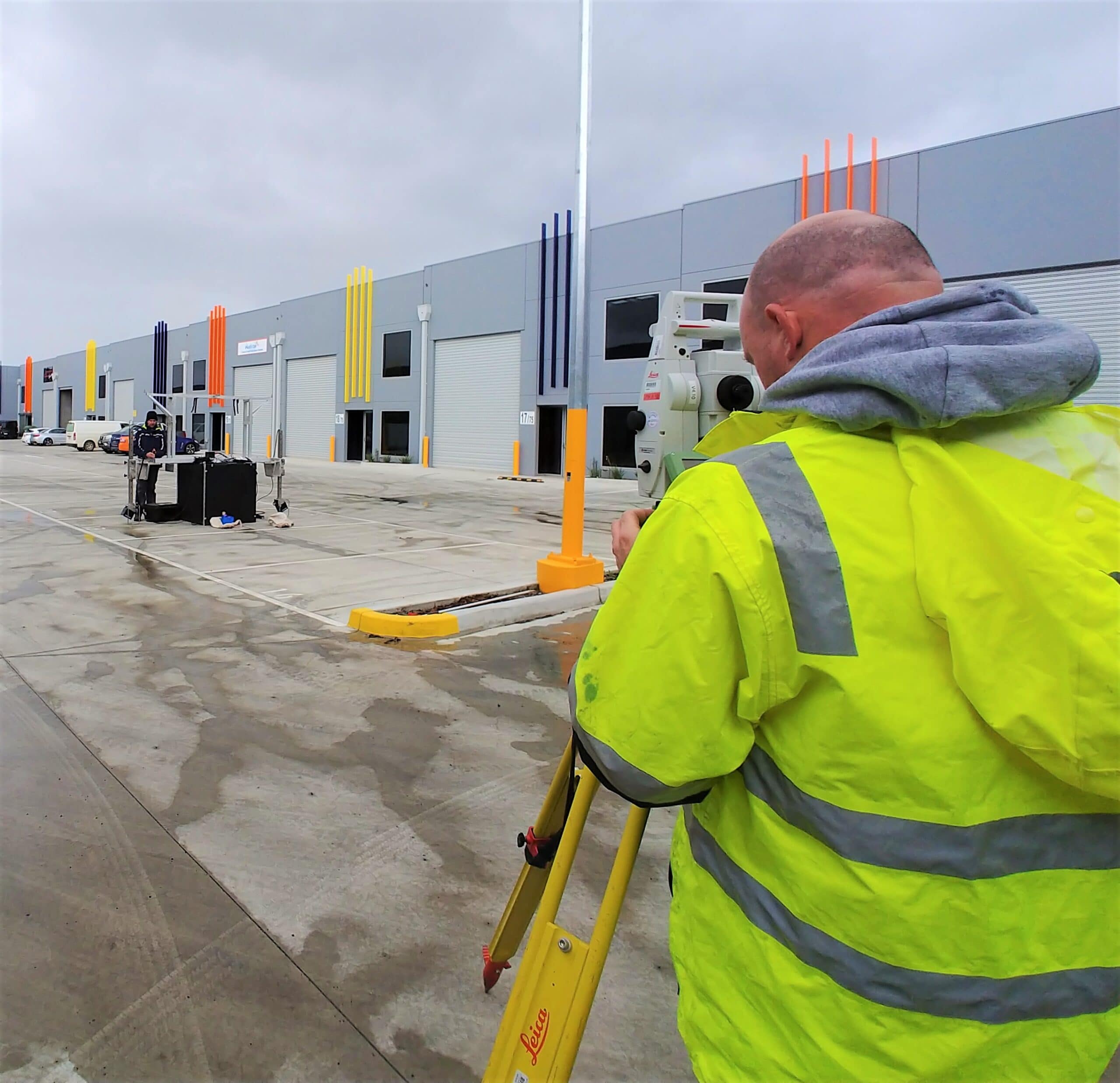
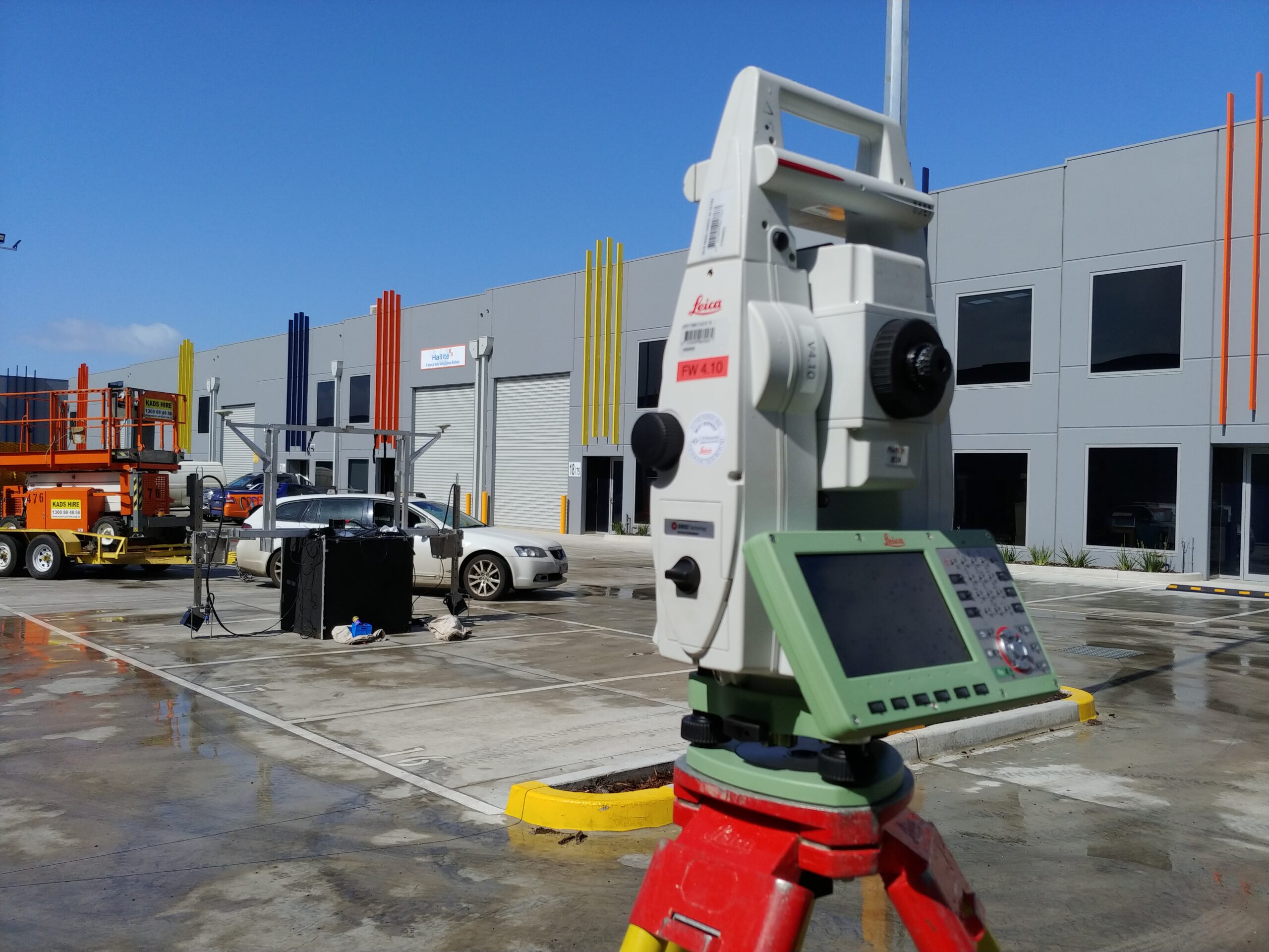
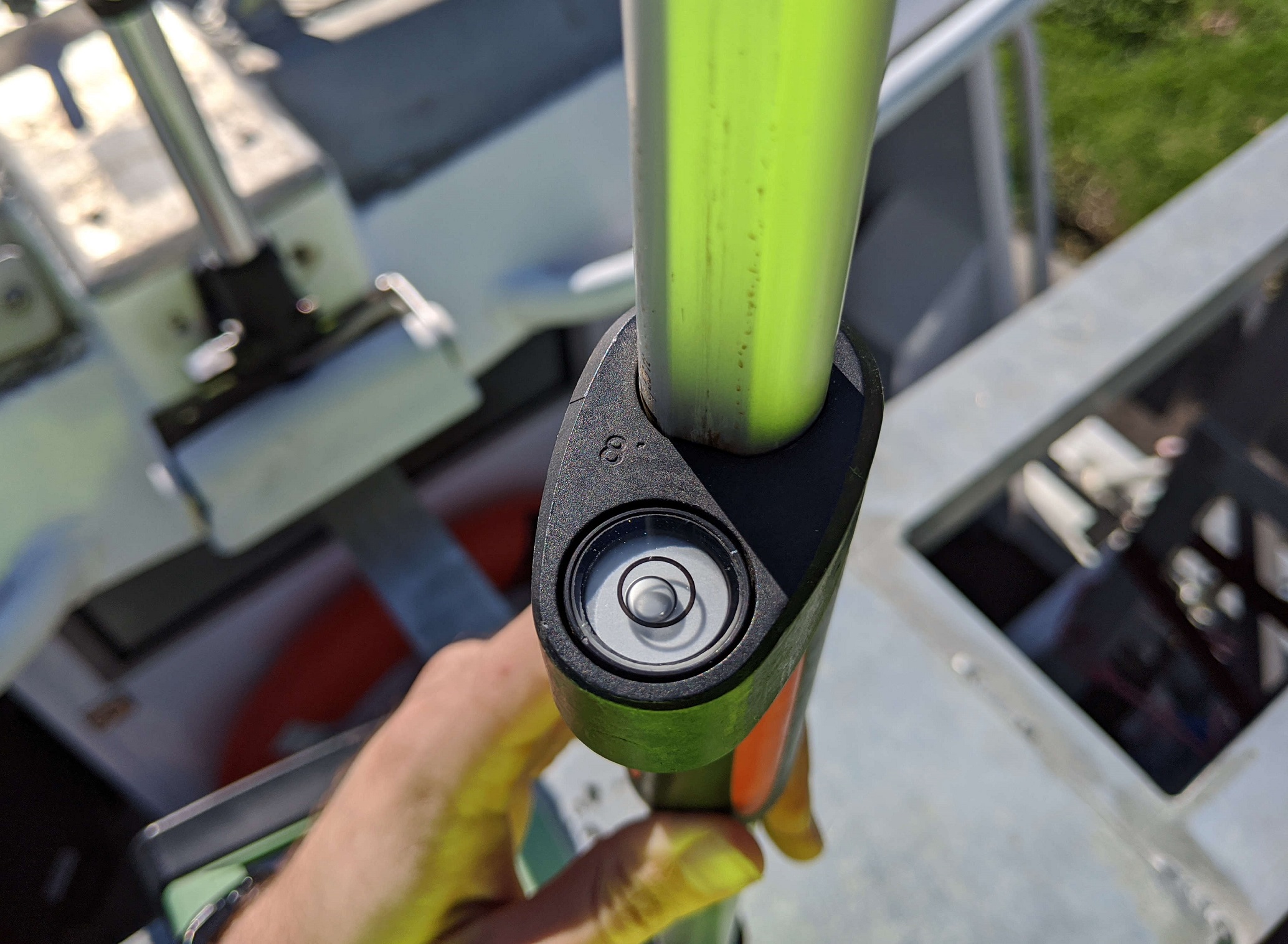
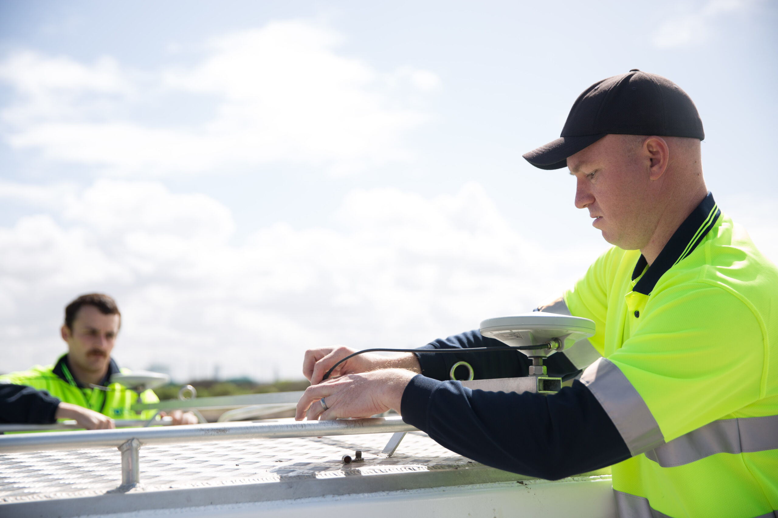
Dimensional Control
For a survey platform to be capable of achieving the most stringent survey standards, a dimensional control survey must be undertaken during its mobilisation. A dimensional control survey determines the x-y-z offsets between survey system sensors and corrects for misalignment errors . This is integral to all survey platforms to ensure that the data that is captured is as accurate as possible with the least amount of uncertainty attributed to the surveyed depths.
Total Hydrographic can provide dimensional control services to survey platforms during their mobilisation phase through the use of Total Station and associated specialised software to within millimetre tolerances.
Undertaking accurate dimensional controls mitigates the risk of delays due to unresolved misalignment errors. Furthermore the surveyor can be assured that their survey platform is capable of achieving the required survey standard that their client or project requires.
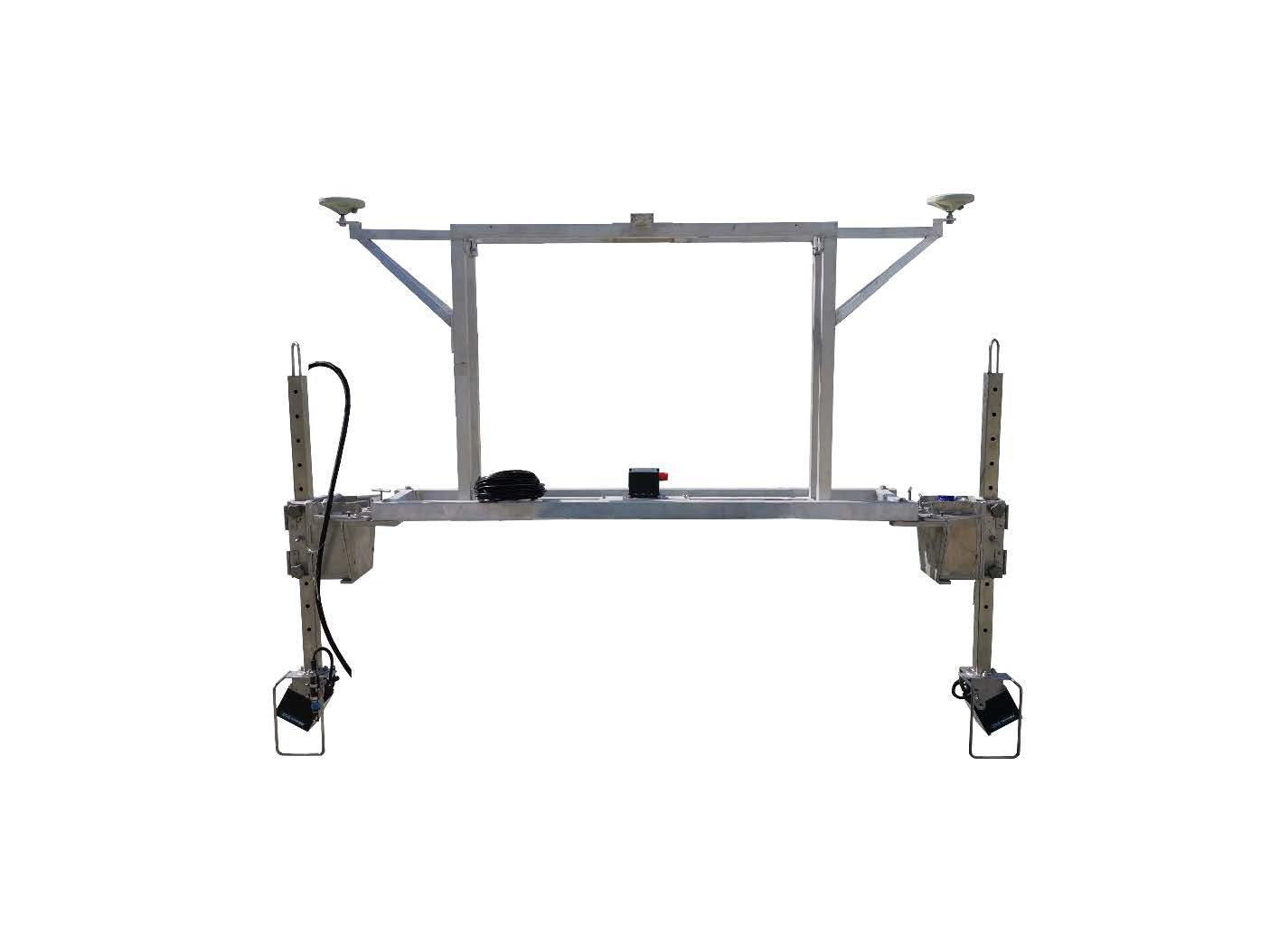
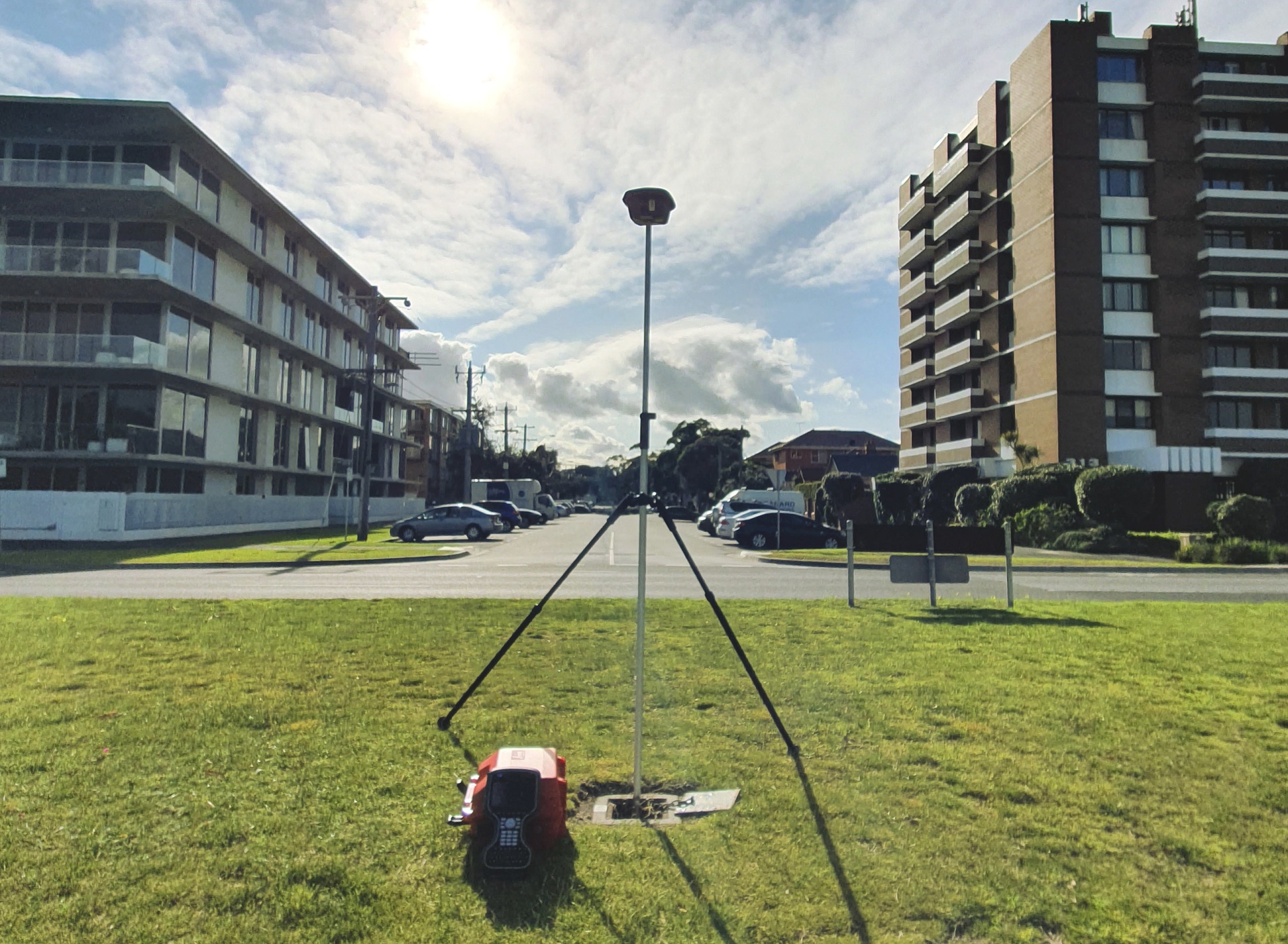
Positioning (Static and Dynamic) System Validations
A survey platform’s Inertial Navigation System (INS) is the unit that integrates its Inertial Motion Unit (IMU) with vessel GNSS positioning. This system must be validated both statically and dynamically to ensure it is achieving the required survey standards.
Total Hydrographic can validate the survey platforms positioning systems with a combination of Total Station and independant RTK GNSS rover.
Avoid having costly delays or uncorrectable motion artefacts in your datasets by engaging Total Hydrographic to assist in comprehensively calibrating and validating your positioning systems. Start your project off knowing that your system is performing as it should be rather than trying to resolve issues in post processing. Not all errors can be resolved post survey so it is best to ensure they aren’t present in the first place.
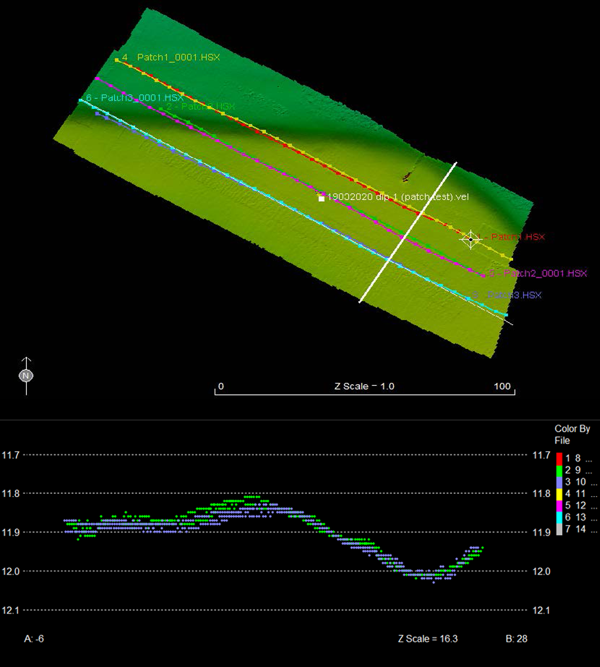
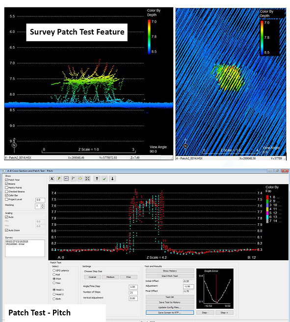
MBES System Calibration
The installation of a sonar system in its reference frame is never perfect and small misalignments are always present. This is especially the case if the sonar has to be redeployed each day. Without resolving these misalignment errors within a system can result in exponential errors in your final observations.
A system out of calibration can cause survey errors which propagate in size as water depth increases. Knowing how to calibrate an MBES system properly is vital to ensure you consistently produce accurate surveys and minimise any artefacts within your final surface. A one time solution can often be found, however a proper calibration will ensure the calibration parameters can be re used and relied upon on a repeatable system.
Incorrectly calibrating a system can induce further errors into the data. Total Hydrgraphic can provide calibration services and training to ensure your survey system is performing at its optimal capacity. This includes identifying suitable subsurface features around your survey area which can be used to undertake a calibration. Once established, a calibration check can be quickly executed to validate the system is still in calibration.

3D Channel Design
The objectives of the survey was to provide full bathymetric survey and provide a volume assessment for the renourishment site to meet the 3D design model. The data that we provided allowed the client to make an informed decision, based on quantitative and visual data presentation, as to the best mode of practice for dredging and renourishment operations.

Reservoir Study
In a drought prone country like Australia, where millions of people rely on the country’s many reservoirs for a safe and dependable water supply – efficient, forward thinking and strategically planned reservoir management is crucial. The risk involved in reservoir management can be mitigated with quick access to relevant and accurate data.

Underwater Inspection Survey
Total Hydrographic specialises in underwater survey and scanning and can utilise a variety of survey sensors to capture relevant data for clients. The Kongsberg MS1000 Mechanical Scanning Sonar used by Total Hydrographic is an example of a system that is ideal for inspecting underwater structures.
System Validation and Compliance Assessment
Does your survey platform require a compliance assessment to ensure that it is capable of achieving the required survey standard specifications? Does your organisation need guidance on what system is suitable to achieve the project objective?
Total Hydrographic is experienced in providing consultancy and in-field assistance during system validation and performance testing against industry standards such as IHO Survey standards and HydroScheme Industry Partnership Program (HIPP) requirements. Total Hydrographic can also design and tailor non-standard validation testing according to specific client requirements.
With experience in a multitude of Hydrographic survey systems and Inertial Navigation Systems (INS), Total Hydrographic’s skilled and experienced Hydrographic Surveyors can be relied on to provide the authoritative assessment of your survey platform.
Surveying Service and Traning
Do you have a project that requires the use of a Multibeam Echo Sounder (MBES) capability but do not have the resources or expertise to operate such a system efficiently?
Total Hydrographic is able to provide onsite training to your organisation and staff in order to be competent with relevant survey equipment. This is a great way to promote self reliance within an organisation as well as reducing cost by efficiently utilising staff capabilities.
Total Hydrographic also provides a complete survey capability package that includes a fully mobilised MBES system, commercially rated survey vessel, associated hardware and software and a qualified coxswain/MBES technician. With such a package, your project can utilise a fully operational MBES system immediately. For a full breakdown of included items and specifications, please see our Survey Capability Package – Multibeam Echo Sounder

Harbour Dredging
A corner stone of Total Hydrographic’s operations is to provide underwater survey solutions that can help Port and Harbour Authorities determine an appropriate dredging solution for their waterways. Dredging solutions often takes place because of sedimentation gradually encroaching in navigable waterways, and or when Port and Harbour authorities look to expanding their operations.
")
A Rockwall
The results from a rock wall scanning project were processed and thoroughly analysed. The scan was undertaken to validate that the rock wall had been accurately constructed as per its design. Cross Section Profiles were extracted from this data and can be seen in the images.

Submerged Trees
This image is an extract from a hazard clearance survey of a lake. The client needed to know that there was a minimum clearance depth of water available at particular water levels. There were many hazards on the lake bed, however the survey revealed that they were all deeper than the client’s required minimum depth.
Hydrography is the science of measuring and describing physical features within water bodies. Hydrography is used for navigation, habitat mapping and hazard identification.
Address
79 Cook Road, Bli Bli, 4560, QLD