Explore Our Latest Blogs
Total Hydrographic are your certified Hydrographic Surveyors and Marine Mapping/GIS professionals.
Our Services
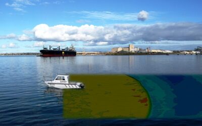
Bathymetric Surveys
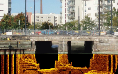
Side Scan Sonar Surveys
Hydrographic Data Analysis
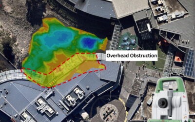
Terrestrial Surveying
Hydrographic Consultancy

Multibeam or Single Beam Survey for Your Project? – Part 2
Our clients are often faced with a choice between opting for a Multibeam or Single Beam survey solution. Part of Total Hydrographic’s role is to help you ascertain what is the most suitable solution for your situation. This requires a detailed conversation and an...
Multibeam or Single Beam Survey for Your Project?
When looking to survey waterbodies, our clients are often faced with a choice of opting between a Multibeam or Single Beam survey solution. Part of Total Hydrographic’s role is to help you ascertain what is the most suitable type of survey for your situation. This...

Multibeam Surveys for Your Marina
Multibeam with Total Hydrographic Total Hydrographic’s highly skilled staff have the capabilities to monitor and map your Marina to the highest hydrographic standards. We own and operate a Multibeam Echo Sounder (MBES) which provides an efficient and wide coverage...
Bathymetric Survey Types
What lies beneath the surface of the endless ocean? It has been the subject of many conspiracy theories, hasn't it? Despite the debunked legends and baseless rumours, measuring the depth of water beneath the surface is an ongoing task. Mariners and hydrographic...
What Is Hydrographic Surveying & Its Important Elements
Water covers nearly 70% of the earth's surface. Navigating safely over the ocean's surface depends on an understanding of the seabed and subsurface topography. Hydrographic surveying - which involve underwater surveys and studies - provide this type of information....
Manned vs. Unmanned Vessels in a Mine Tailings Dam
An Australian project reveals surprising results at mineral sands mine Over a four-year period, Total Hydrographic undertook a project at a mineral sand mine to survey the condition of the mine’s dredge pond. Survey was conducted utilising manned and unmanned vessels....
What is Hydrographic Survey?
What is Hydrographic Survey? Part of the maritime science study is the analysis, measurements, description, and mapping of features found underwater called hydrographic survey. Bathymetric survey is the mapping of the submarine topography, known as...
Address
14/75 Endeavour Way, Sunshine West VIC 3020
79 Cook Road, Bli Bli, 4560, QLD